Hitchhiking over
the Lofoten Islands

It is the end of August 2019 when I am in Norway for the first time. My backpack is packed with a tent, sleeping bag, and hiking boots, and I am filled with the greatest excitement and thirst for adventure. To counter the Norwegian prices, 10 packs of Asian noodles and granola bars are also part of the trip. I land by plane in Bodø and enjoy the first kilometers between the airport and the hostel on foot. Bodø has a harbor, a few cute cafes and a (for Norway typically) questionably high number of hair salons. There’s also probably the ugliest church I’ve ever seen. Bodø’s local mountain I explore the day after my arrival before I take the ferry towards the Lofoten Islands.

The Lofoten Islands are located in the European Arctic Ocean along the coast of northern Norway.

The Lofoten region has about 24,000 inhabitants.

The land area of the Lofoten Islands is 1,227 km², spread over about 80 islands. 

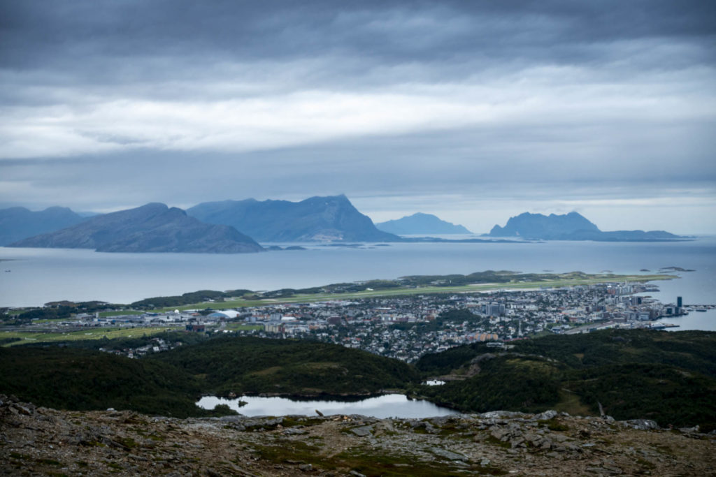
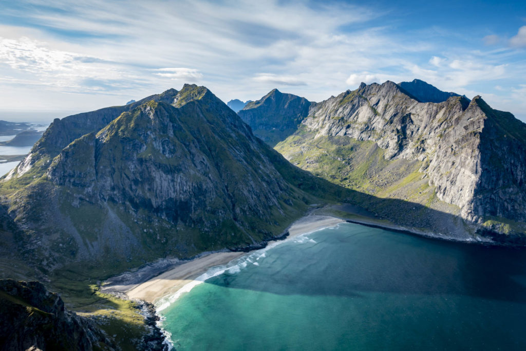
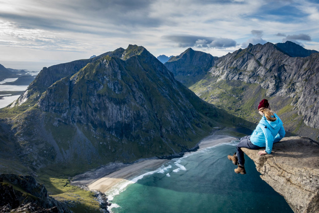
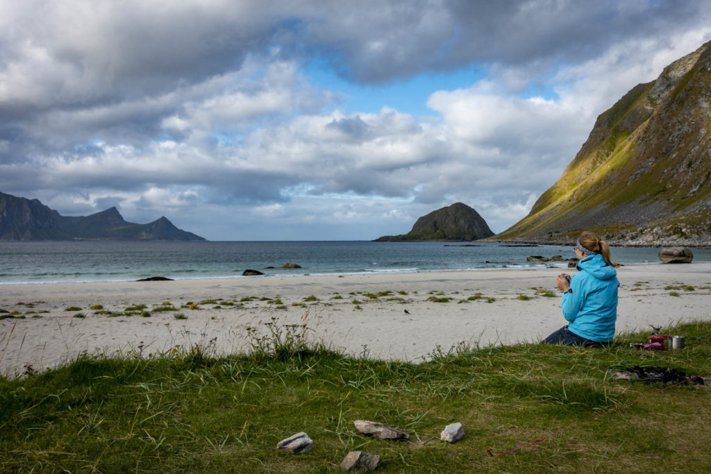
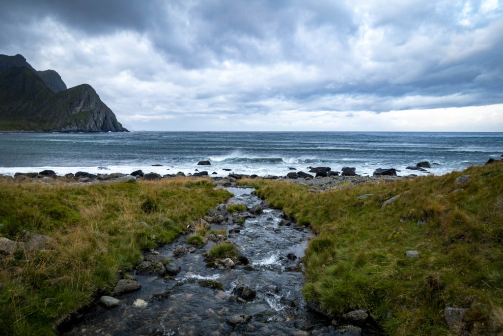
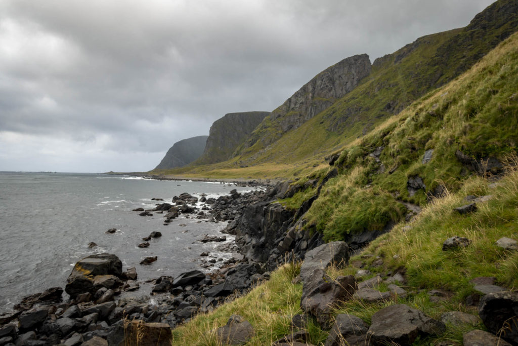
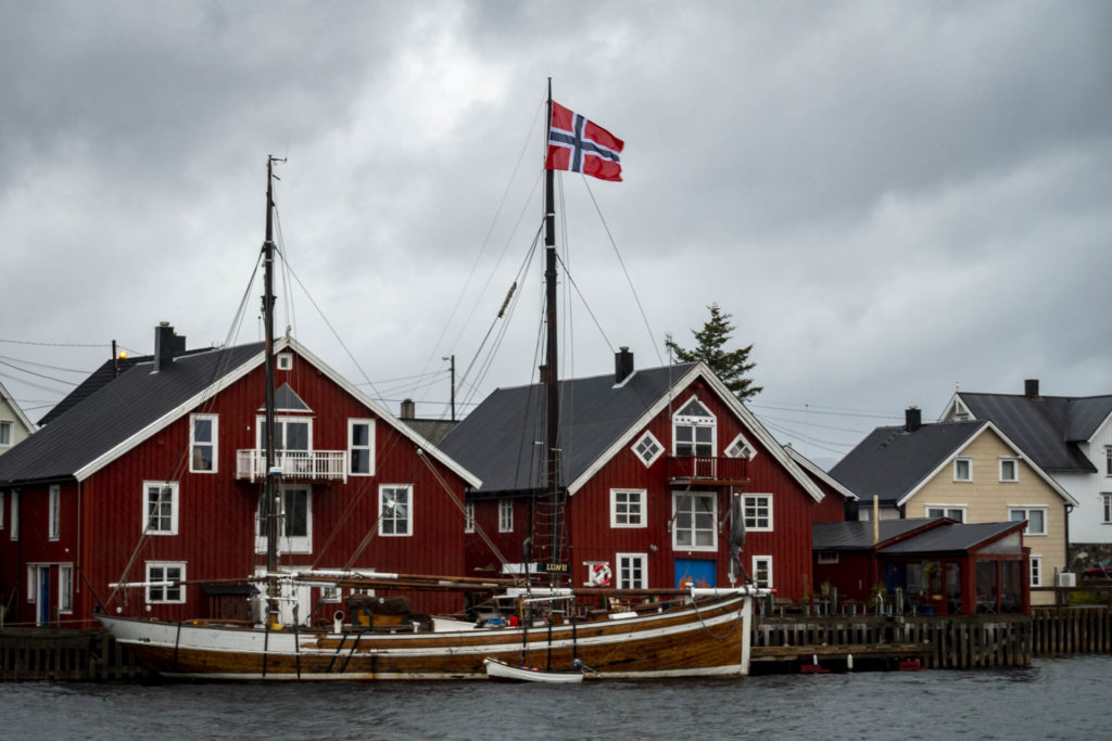
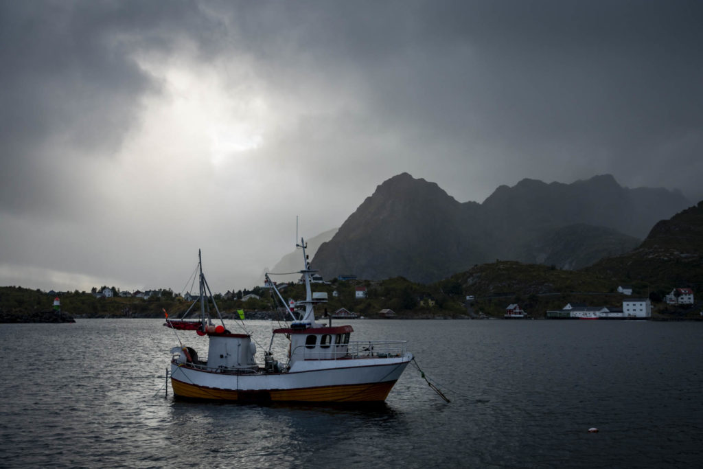
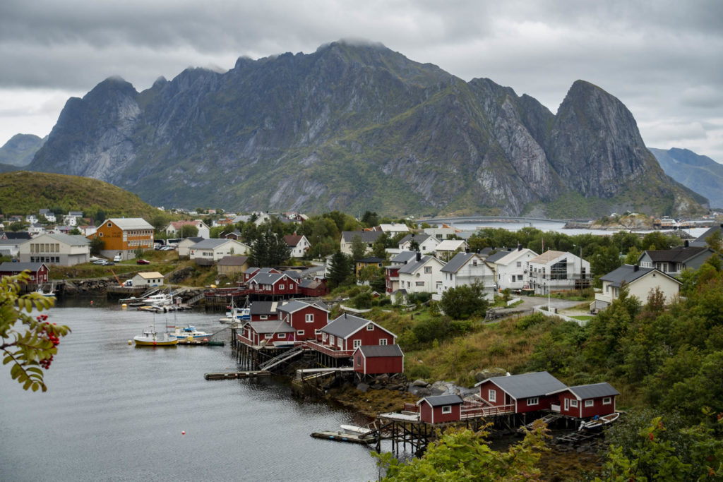
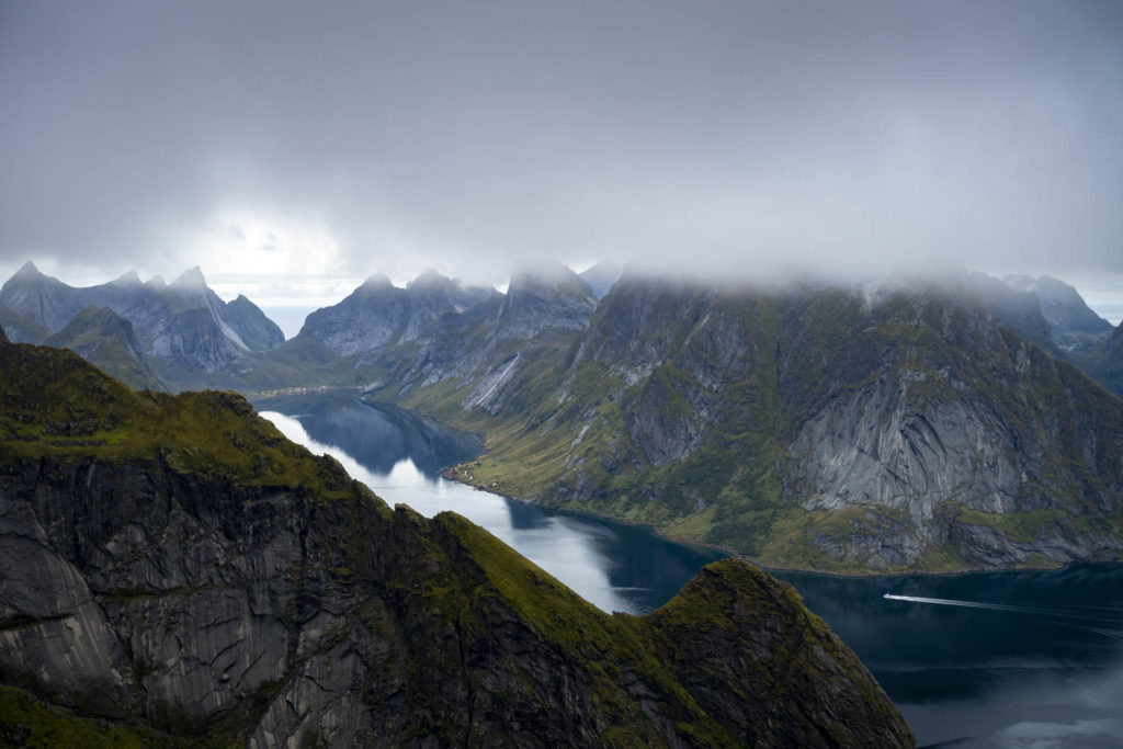
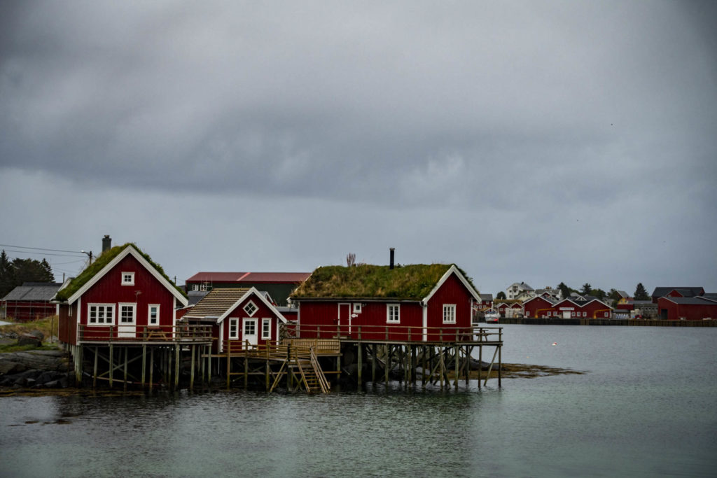
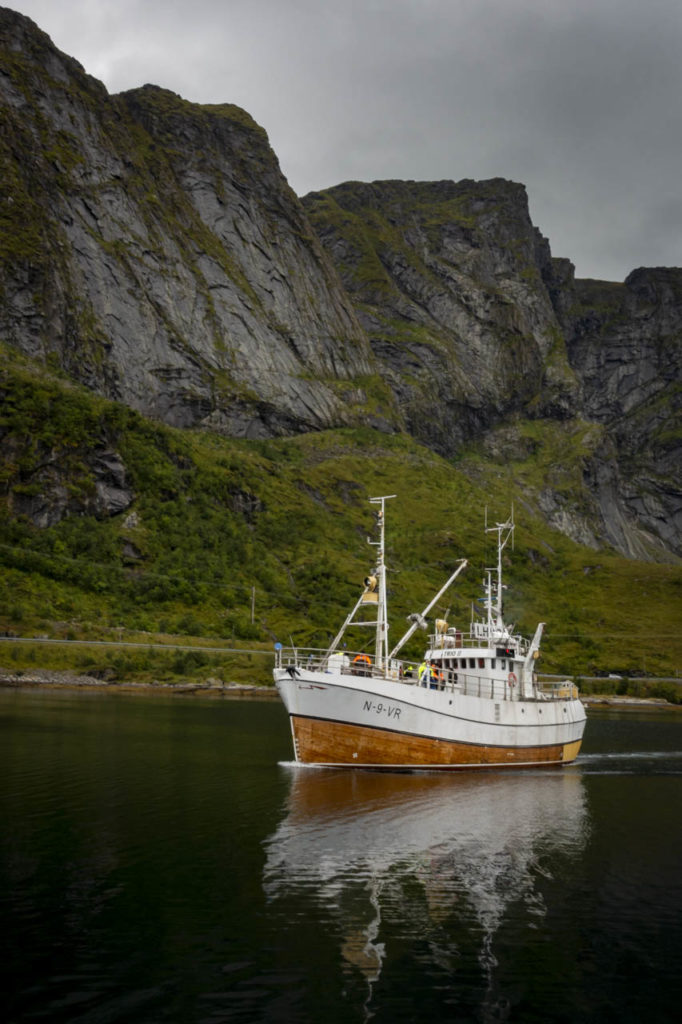
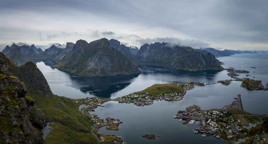
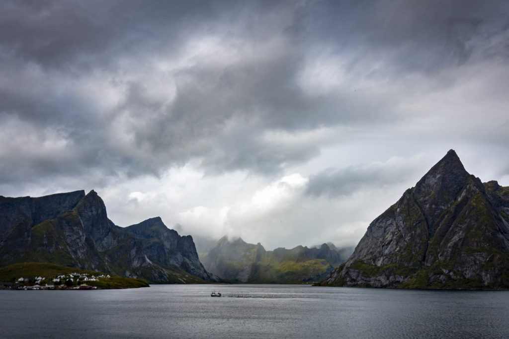
I flew from Berlin via Oslo to Bodø. In Bodø you can stay well and cheaply in the HI Hostel directly in the train station building. Bodø’s local mountain, the Keiservarden (366 m), takes about an hour and a half from the hostel. Once at the top, you can get a first impression of Norway’s beautiful landscape. Undoubtedly, Bodø serves mainly as the gateway to Lofoten. The ferry to Moskenes departs behind the station building and the trip takes about three hours. In August 2019, as a traveler without a car, I was able to buy my ticket directly on the spot when boarding (during peak travel season, it is better to book in advance).

Moskenes

I spend my first night on the Lofoten at the camping site in Moskenes. In the next morning I bridge the rain with some other German hikers in the camping kitchen where I get equipped with instant coffee and travel tips for the next week. Thanks to a kitchen acquaintance I can skip the planned bus ride north and get a lift in the car instead. 

There is one main road, the E10, which runs across the entire Lofoten. There are buses, whose timetable was thinned out at the beginning of September, but basically in operation (www.reisnordland.no). I mainly hitchhiked on my trip and it worked great (before Covid though). The most flexible and expensive way to travel is with a rental car.

Kvalvika Beach

Today’s destination is Kvalvika Beach, a bay on the northern coast of Moskenesøy Island, accessible by land only on foot. I get dropped off at Fredvang and walk the remaining three kilometers to the start of the trail. Across the street from a small parking lot the hiking trail begins. Kvalvika Beach is only one mountain pass away. The climb is moderate, yet I find the rocky terrain challenging with my heavy backpack. After half an hour I reach the highest point and enjoy the first view of the beautiful bay. Not another half hour later I arrive at the beach and find my home for the night on the surrounding grassy areas. It is quiet here at the end of August and so my tent is one of the first and only a few more shall follow. One of them belongs to Benni and Steve from Munich with whom I sit together in the evening with a tea at this beautiful spot.

The next morning I hike to the mountain Ryten (543 m), which is situated next to the bay. Up here, a view opens up over the breathtaking landscape of the Lofoten: a mountain landscape rugged by water, with rough peaks and even steeper slopes. It is windy as hell, but even the strongest gust of wind can’t spoil the pleasure of this view. On the mountain I meet a girl who is familiar with the best photo spots and poses. Mutually we capture the moment for each other with the camera.

Back at the beach I am so heated up from hiking that the idea of a refreshment in the sea seems terrific to me. Clean I become in the ice-cold water, no question, but I also become freshly breaded thanks to wet skin, strong wind and blown sand. After a lunch, I remove my tent and leave Kvalvika Beach towards civilization. 

If you arrive via Moskenes, you will find the local campsite just opposite the ferry station. Wild camping is also allowed on the Lofoten thanks to the Everyman’s Right. The beaches are wonderfully suitable for it. During my trip, this was possible at the beaches Kvalvika Beach and Haukland Beach for free and at Unstad Beach for a few kroner (as of 09/2019). At Kvalvika Beach you can get water at a stream.At Haukland Beach and Unstad Beach there are toilet blocks.

Haukland Beach

Back on the road, I head north with my thumb out. The first carpooling opportunity arises quickly and coincidentally not with strangers, but with Benni and Steve from the night before. During the day I sit in four more cars. After Swiss, Thai Swedes and Norwegians, I arrive with two Argentinians at the day’s destination, Haukland Beach. These days I have my first hitchhiking experiences ever. That I actually always arrive at the, not necessarily centrally located, desired destination, I do not take for granted, but for great gestures, which I gratefully remember. 

After Kvalvika Beach has already blown up my idea of a Nordic bay, at Haukland Beach I have definitely arrived in a Caribbean lookalike. Turquoise water is carried in shallow waves onto the yellow sandy beach. There are also grassy areas right next to the beach where I can pitch my tent.

From the beach I start my hike to the Himmeltinden (962 m) the next morning. The hiking trail starts on the other side of the road from Haukland Beach and leads first in small serpentines up to a flat area. From here on the path to Himmeltinden is signposted. Already during the steep ascent it is difficult to turn the eyes from the incredible scenery, which can be admired from the summit in 360°. On the way back I walk first to Uttakleiv Beach and from there along the coast back to Haukland Beach. After 6 hours I am back at the tent and get ready for the continuing journey.

Unstad Beach

The destination for this day is also a beach, Unstad Beach. I reach the spot, which is very popular among surfers, after two hitchhikes. At Unstad Beach I leave a few Norwegian kroner in a cash box for the overnight stay at the beach. When I arrive one of the other campers is trying to build a small windbreak around his tent out of stones (Warning!). The previous night he could hardly sleep because of the wind (Warning!). After a noodle soup and a hot chocolate I go to bed. Also this night the wind gets really strong, so that my tent is involuntarily asked to dance. I try to support the tent poles from the inside and thus hardly find sleep. At 5 o’clock I declare the night over and tidy up my things. Luckily, there is one place where I can shelter from the elements – the restroom. There I spend another hour recovering, drinking coffee and weighing my options. The chance of getting a ride to the main road I consider slim due to the early hour. The option of walking 10 km to this very road I consider wet, cold and unpleasant. The 9 km long hiking trail along the coast to Eggum I consider a reasonable alternative. I was advised against this hiking trail in the camping kitchen in Moskenes due to the lack of variety (Warning!), but after excluding the other options, I make my decision. Anyway, there is nothing better to do and the rain clouds hang in the mountains, so it is relatively dry on the coast. So off we go! On the first kilometers it is quite funny to fight through the messy weather. As the trail continues uphill, the slope down to the sea gets steeper and steeper. At times there are chains to hold on to and at times I no longer recognize where the path leads along. All this would be relatively unspectacular and bearable, wouldn’t there be this terribly strong wind, to which I offer an excellent point of attack with my large backpack. So excellent that I am pressed to the ground twice by the wind. Since there is besides me, the slope and the thunderous sea also my luck and a large amount of sheep shit, it is not surprising that I land with the hand once directly in a pile of excrement. Gone with the wind into the shit, I get quite respect for the situation, if not even fear. No one knows I am here and neither the destination nor cell phone reception are in sight. By tracking my GPS signal on my phone, I try to calm my nerves. As the altitude meters decrease, so does my anxiety. After the mountain, the last kilometers lead over meadows along the coast to Eggum. Once there, I want to get away quickly, towards civilization, into the dry, with my hands under a water tap. After wading through the rain for half an hour in direction of the main road, I find a ride that takes me to Sandvika Camping in Ørsvågveien. Saved!

Sure, summer is warmer, summer is sunnier, summer is more predictable. But the Google finding “From September you can see northern lights” finally made me book plane tickets for the end of August. It’s not too cold yet and there’s a (small) chance of auroras, which I didn’t see on this trip, by the way, or at least not directly (see Åndalsnes). Also due to the masses of tourists that are supposed to be out in the summer, I was happy with my decision.

Henningsvær 

The next day I don’t want to move myself or my tent significantly. Instead, I take the bus to Henningsvær to buy souvenirs and treat myself to a good meal. The place is gray, wet and deserted and I am exhausted, so a cheerless day passes.

From the campsite in Ørsvågveien I take the bus back to Moskenes the next morning. It’s another rainy day, so it’s perfect for a three-hour bus ride with great views. The cheerlessness of the previous day gives way to nostalgia and I am happy about all the unforgettable experiences of the last days.

Reinebringen

On my last day on the Lofoten I leave the camping site in Moskenes and head for Reine. The weather prospects don’t look bright, but I don’t want to miss the last item on my Lofoten bucket list, the view from Reinebringen (448 m). From Moskenes, I walk along the road towards Reine before arrows on the ground point to the trail up Reinebringen. The trail consists almost exclusively of stone steps, only shortly before the finish there are a few meters of mud to overcome. Due to the thick cloud cover, I prepare myself not to be able to enjoy the famous view from the Reinebringen. But this is not the case at all. The complete extent of the view on the Reinebringen only opens up at the very end, on the very last meter of altitude. The clouds don’t harm the view and the town of Reine and the Lofoten Islands look simply beautiful from up here. 

After the descent I walk through beautiful Reine, enjoy a cinnamon bun and make a round trip with a ferry. 

The next morning I return from Moskenes to the mainland, where I already board the night train to Trondheim in the evening. After six days on the Lofoten, I will go by train via Åndalsnes to the classics Preikestolen, Kjeragbolten and Trolltunga in the south.

0 0 votes
Article Rating
Subscribe
Notify of
guest
0 Comments
Inline Feedbacks
View all comments