3 classics in 5 days:
Preikestolen, Kjeragbolten and Trolltunga
In Norway, I traveled with the Norwegian railroad company VY (https://www.vy.no/en).
A good base for the Preikestolen is Stavanger. There you can buy combined tickets for ferry and bus at the ferry port. This connection takes you directly to the parking lot at Preikestolen.
The hike to Preikestolen is about 8 km long (including the way back) and there are about 500 meters of altitude difference.
The area around Preikestolen is rather stony or muddy, so it is not easy to find a place to camp. Just before the rock pulpit there is a sign behind which camping is forbidden. Some tents were on a green area behind the Preikestolen. A great spot, but whether camping is allowed there, I do not know.
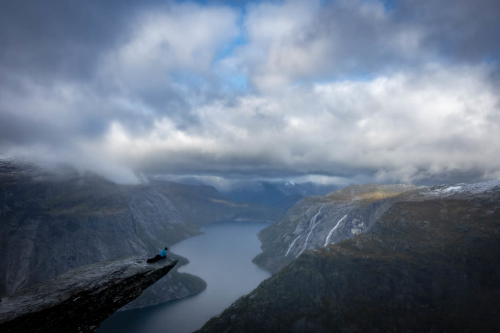
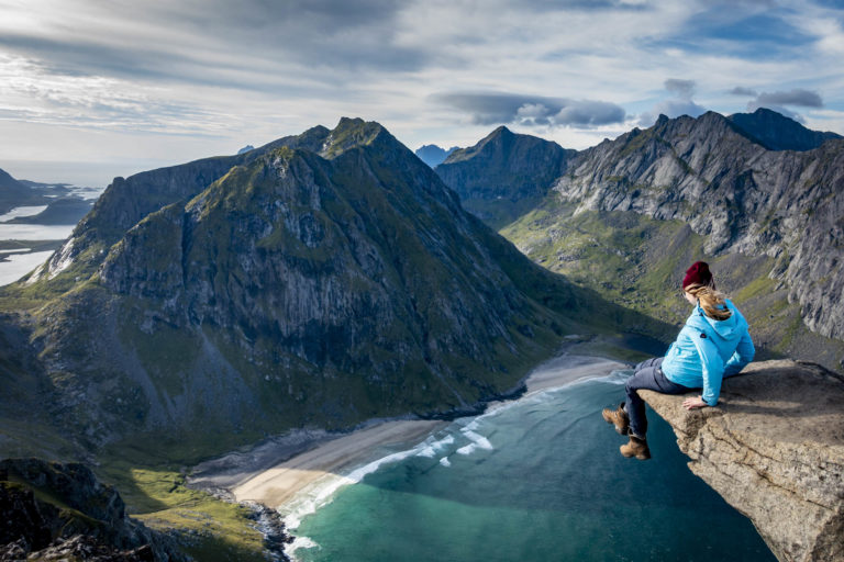
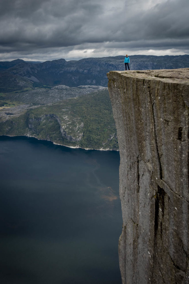
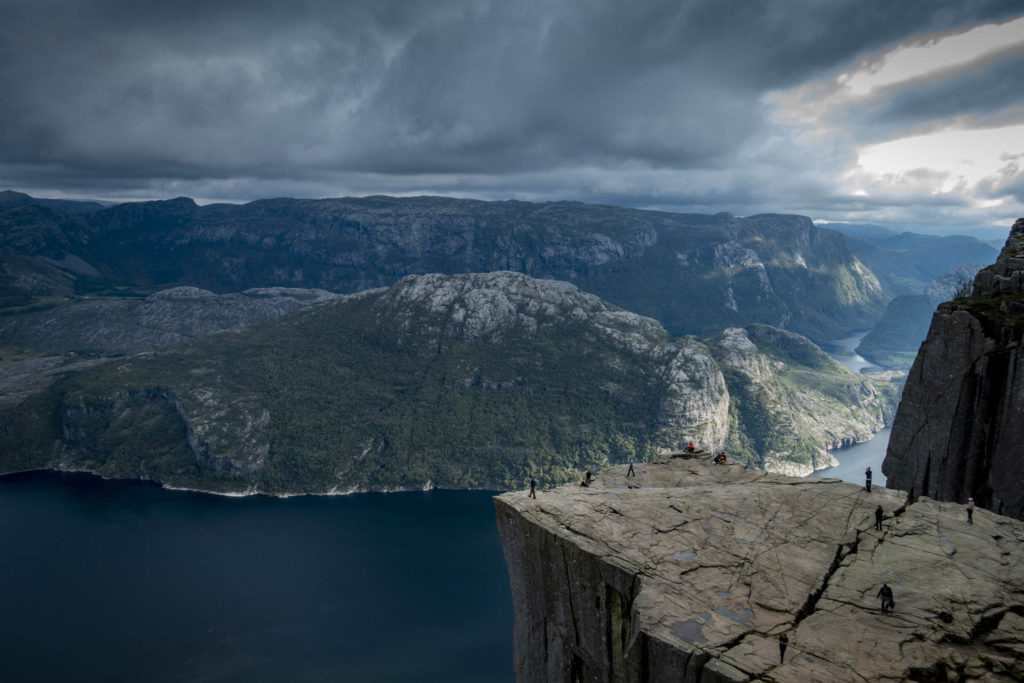
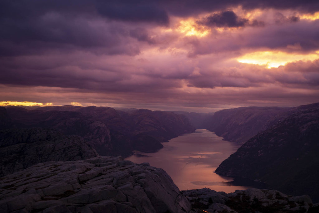
Preikestolen
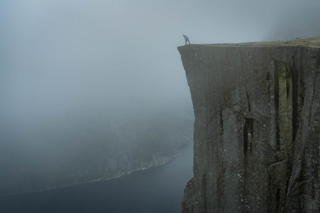
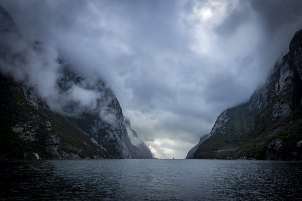
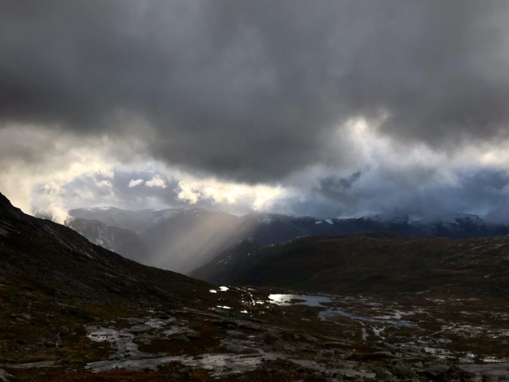
The starting point for my journey in the south of Norway is Stavanger. There I move into a hostel in a decommissioned part of a hospital for one night. That’s totally awesome, also that there is breakfast the next morning together with new mommies. From Stavanger I get by ferry and bus to the parking lot at Preikestolen. Here begins the well-signposted, well-visited and well manageable hiking trail up to the famous rock pulpit. Less than an hour later I am standing in front of the “Predigtstuhl”, a natural stone platform 600 m above the Lysefjord. Shortly before the “From here camping prohibited” sign I find a place for my tent on a small elevation. Afterwards I shoot photos or have them shot and explore the area before the Lysefjord disappears under the clouds in the evening.
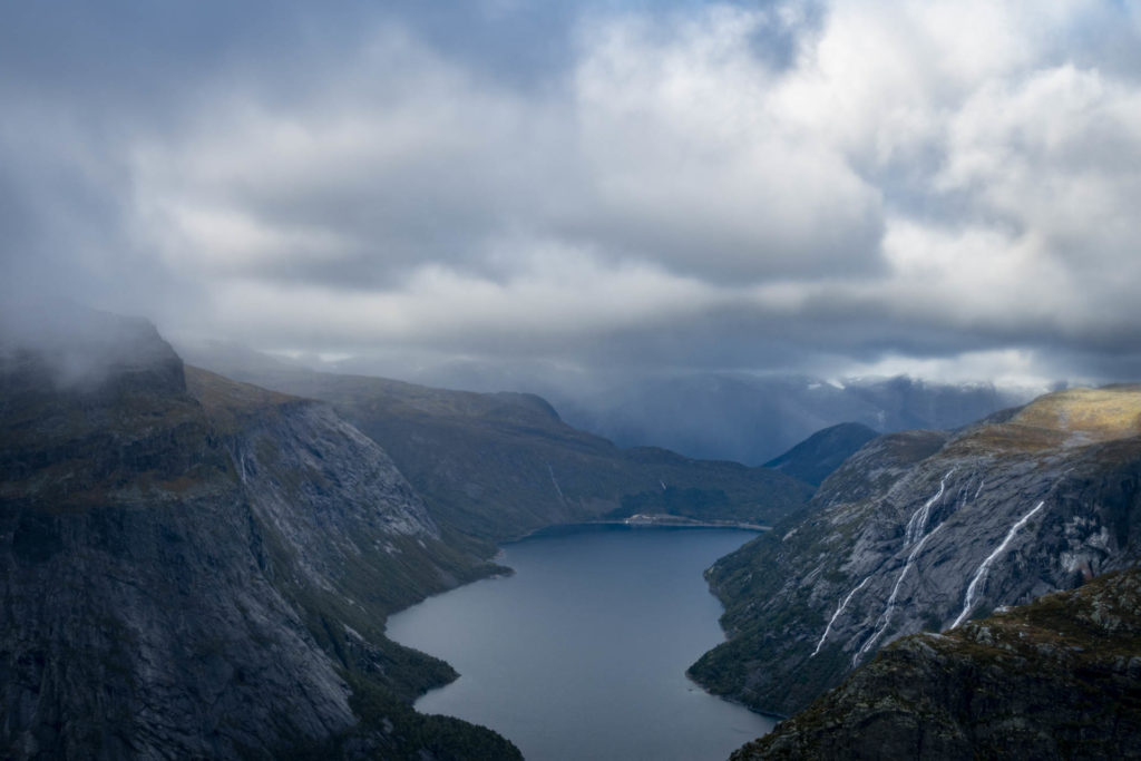
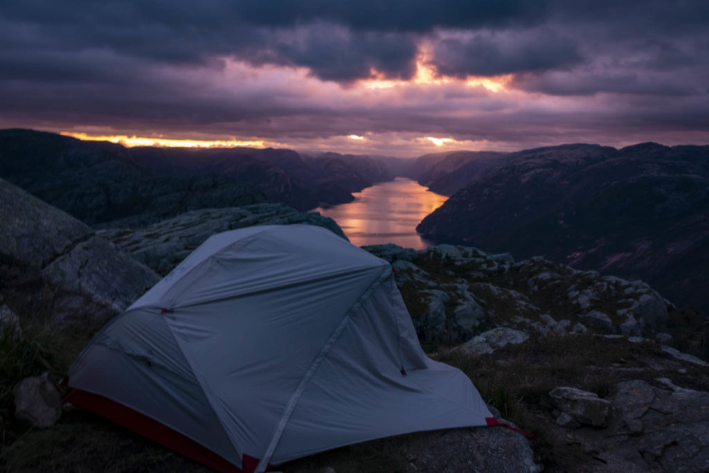
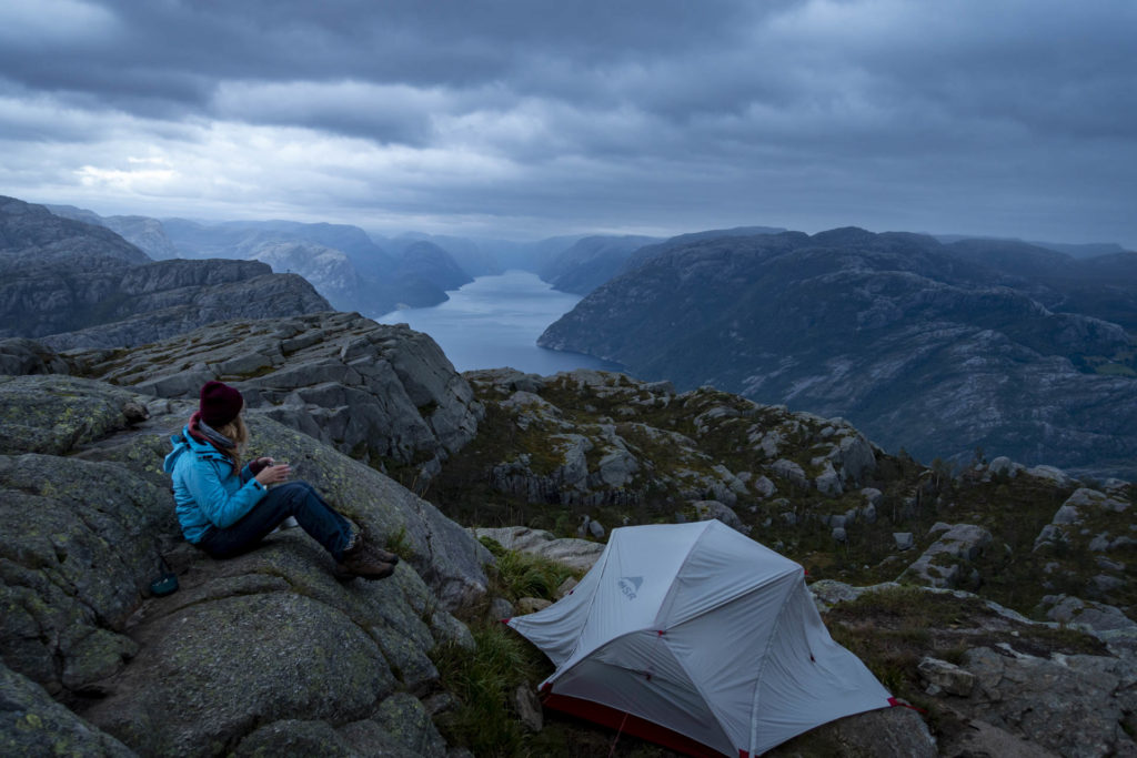
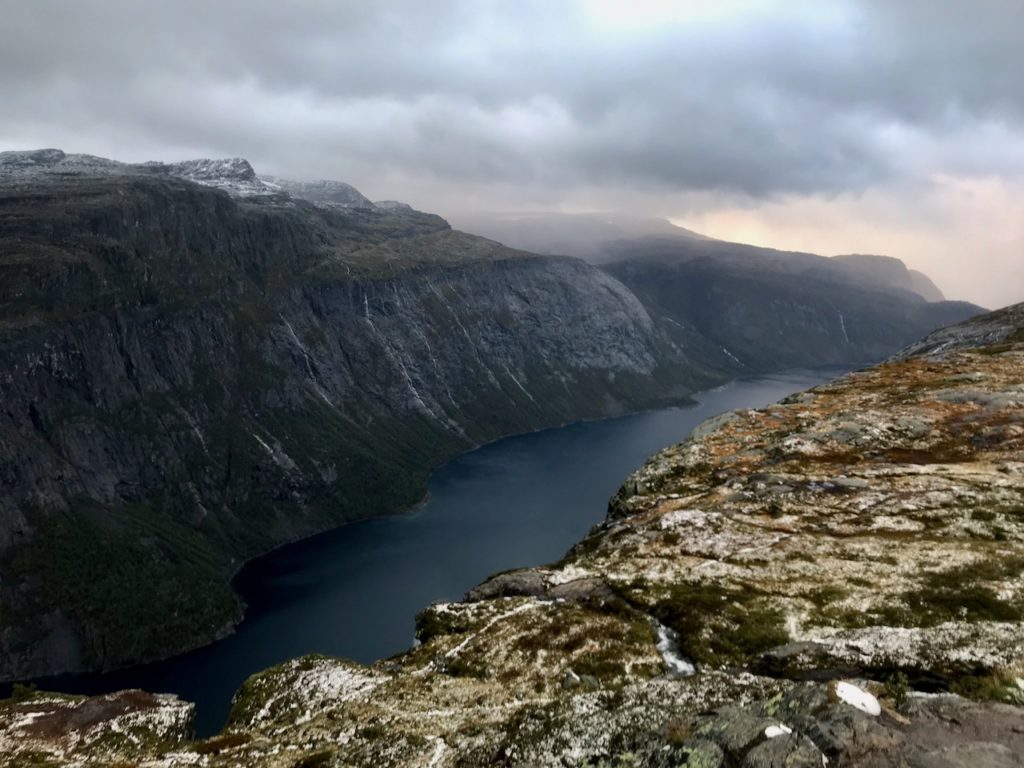
At 7 o’clock I wake up and hardly believe my eyes when I look out of the tent. The cloud cover from the night before has disappeared and the Lysefjord dipped in the most beautiful shades of red comes to light – “no filter needed” 😉 I enjoy the landscape and my breakfast and soon make my way to the next classic.
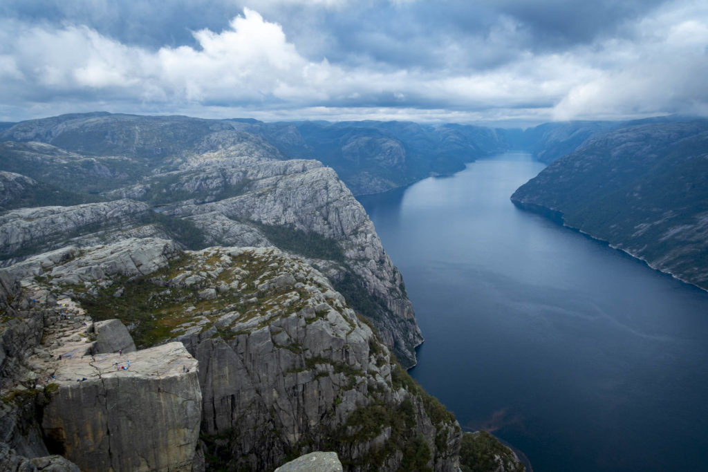
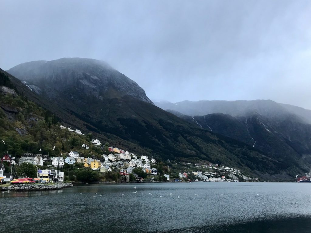
My days in Norway are slowly counted, but two desired destinations are still open: the Kjeragbolten and the Trolltunga. My research showed that there is no direct connection between Preikestolen and Kjeragbolten, all lead via Stavanger. I don’t have time for that, so I plan my own route. From the parking lot at Preikestolen I try to get a ride towards the main road. The only possibility I get is the bus I took the day before. For the kilometers down to the main road I may even ride free of charge. At the main road I stick out my thumb. My destination is Forsand, where the ferry to Lysebotn leaves. It takes a while, not until a car stops, but until one passes at all. Finally, I am lucky and find a ride, which drops me off at 1pm at the Lysefjord Bridge. Quickly I run over the bridge, which I have looked at the day before from the Preikestolen. There is not much time, according to Google Maps it is a 52-minute walk to the ferry, which departs in 60 minutes. Even according to German punctuality I arrive in time at 13:49 at the ferry station, but also have to take a breath. “10 Minuten vor der Zeit ist die deutsche Pünktlichkeit.” 😉
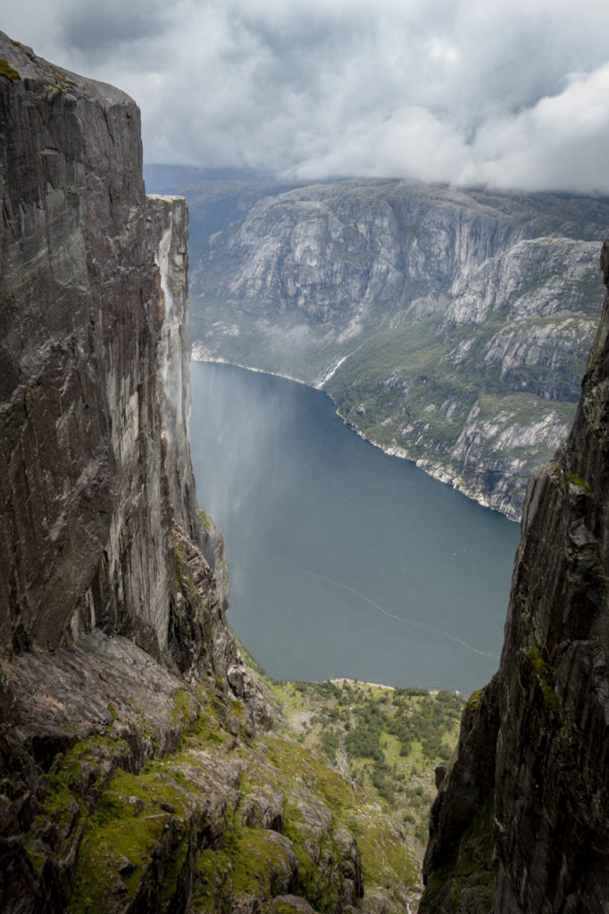
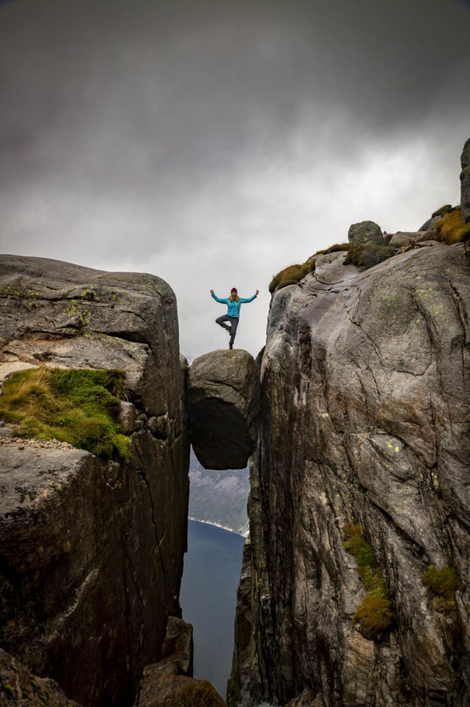
The highest peak along the Lysefjord is on the rock plateau Kjerag (approx. 1,000 m). A popular photo spot on the plateau is Kjeragbolten, a boulder wedged in a crevice.
The starting point of the hike is at the Kjerag Restaurant (Øygardstøl). I took the ferry to Lysebotn and from there a cab to the start of the hike. There is a paid parking lot at the restaurant.
The hike to Kjeragbolten is about 12 km long (including the way back) and there are 500 meters of altitude difference.
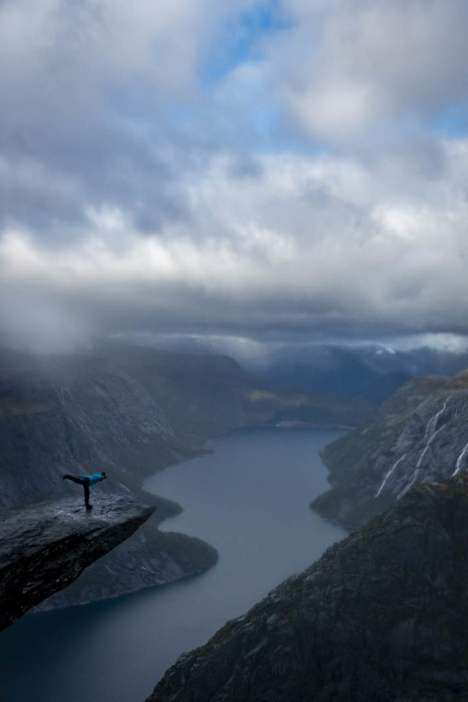
Kjeragbolten
In Lysebotn I spend the night at the campground, where I pitch my tent almost at the lowest point of the meadow. From this rookie mistake saves me a couple from Peru, with whom I arrange for the next morning the hike to Kjeragbolten. According to the weather forecast, the weather should be best early in the morning, so we meet at 8 am at the cab service that is supposed to drive us to the start of the hike. After we ring the cab driver out of bed, he drives us up the serpentine road at the end of the valley to the parking lot Øygardstøl at the starting point of the hike. There we meet the “parking lot attendant”, who does not forbid us, but also does not advise us to hike to Kjeragbolten today. The visibility is so bad anyway that you can’t see the stone and the Lysefjord from above. After long consideration I agree that it probably makes no sense and drive with the others back down into the valley to the campsite. There we sit in the camp kitchen and are disappointed to see that it is clearing up more and more. When I discover blue sky, I finally bite myself in the ass. Unfortunately, the Peruvians don’t have time to start a second attempt for the hike. A couple from the Czech Republic is just getting ready to drive with their rental car to the starting point of the hike. I take my chance and run after the two to ask if they would give me a ride. Arriving at the top for the second time in a few hours, the “parking lot attendant” greets my familiar face with a grin and wishes me a good time.
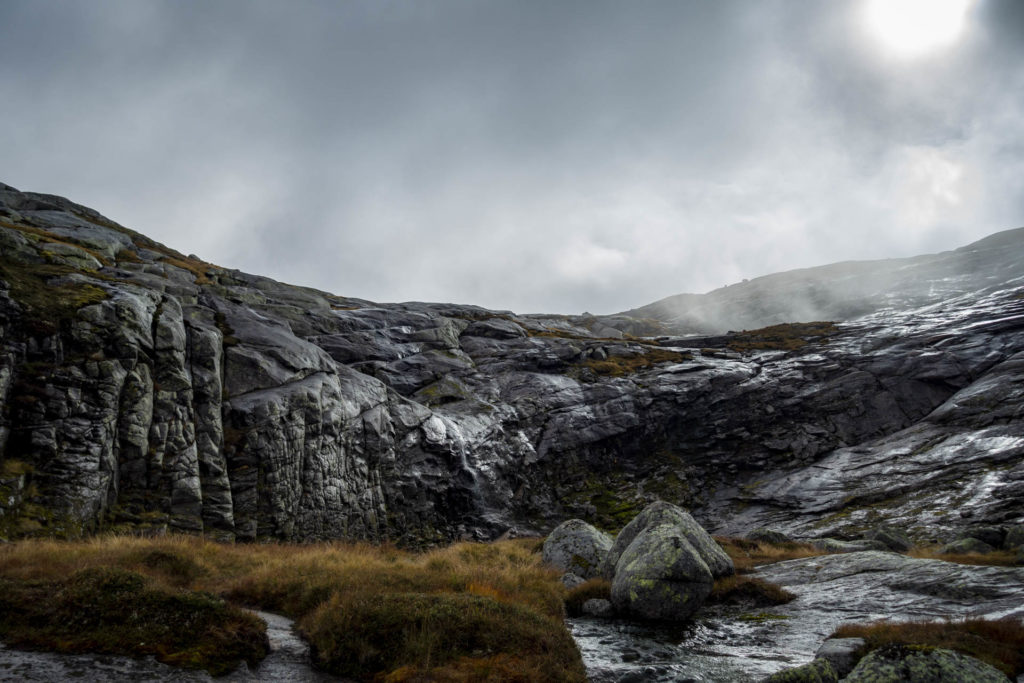
The first few kilometers turn the trail into my most challenging hike yet in Norway. On slick stone, which is very slippery due to the rain, I walk or pull myself uphill on the attached chains. After falling twice on the way back, I use the chains to maneuver myself backwards down the mountain, which works wonderfully. But of course there is still the time between ascent and descent… After a few kilometers I arrive on the ridge and the path becomes more relaxed. The Lysefjord and Lysebotn show themselves only briefly between the clouds. After about 1.5 hours I climb through a small canyon and then he floats in front of me, the Kjeragbolten. It even clears up a bit and I can see the Lysefjord below. Now I face the question of all questions: Do I get on the stone or rather not? This question had already kept me from sleep at home in Berlin. As I see the stone now before me I have a good feeling and trust me to dare “the step”.I dare the step even twice, because my chosen photographer messes up the photos at the first attempt, sweetly meant. Watching me on the stone apparently made him more nervous than I was. The second attempt works better and I even include the one or other yoga pose. So my adventure Kjeragbolten finds a beautiful ending.
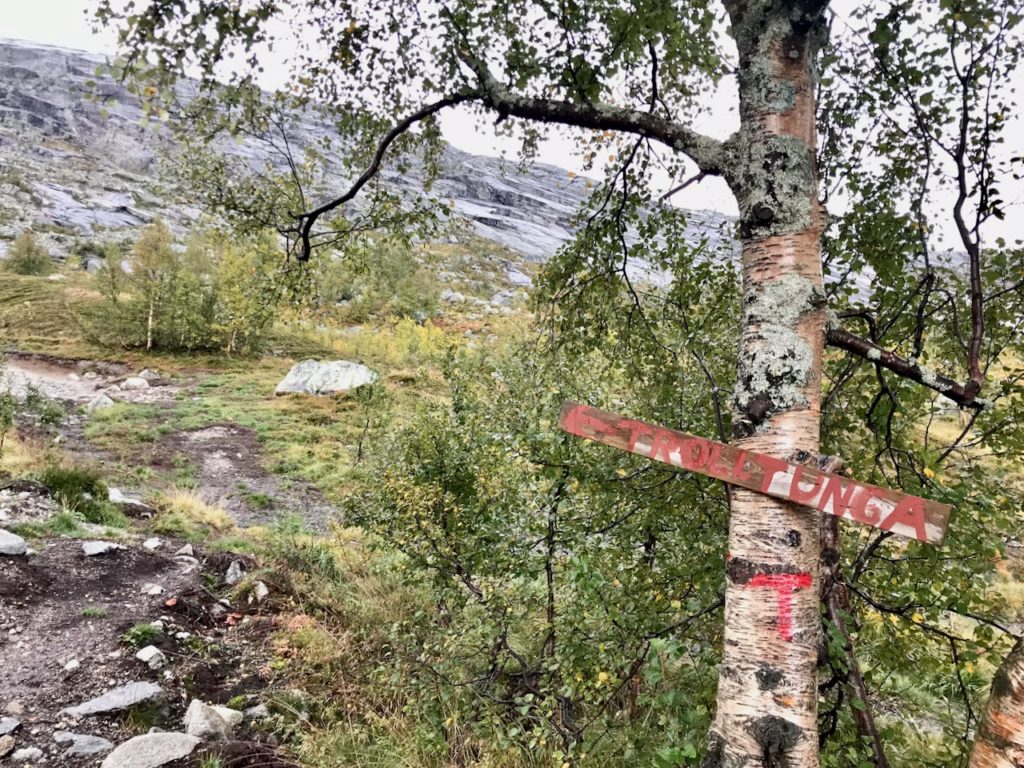
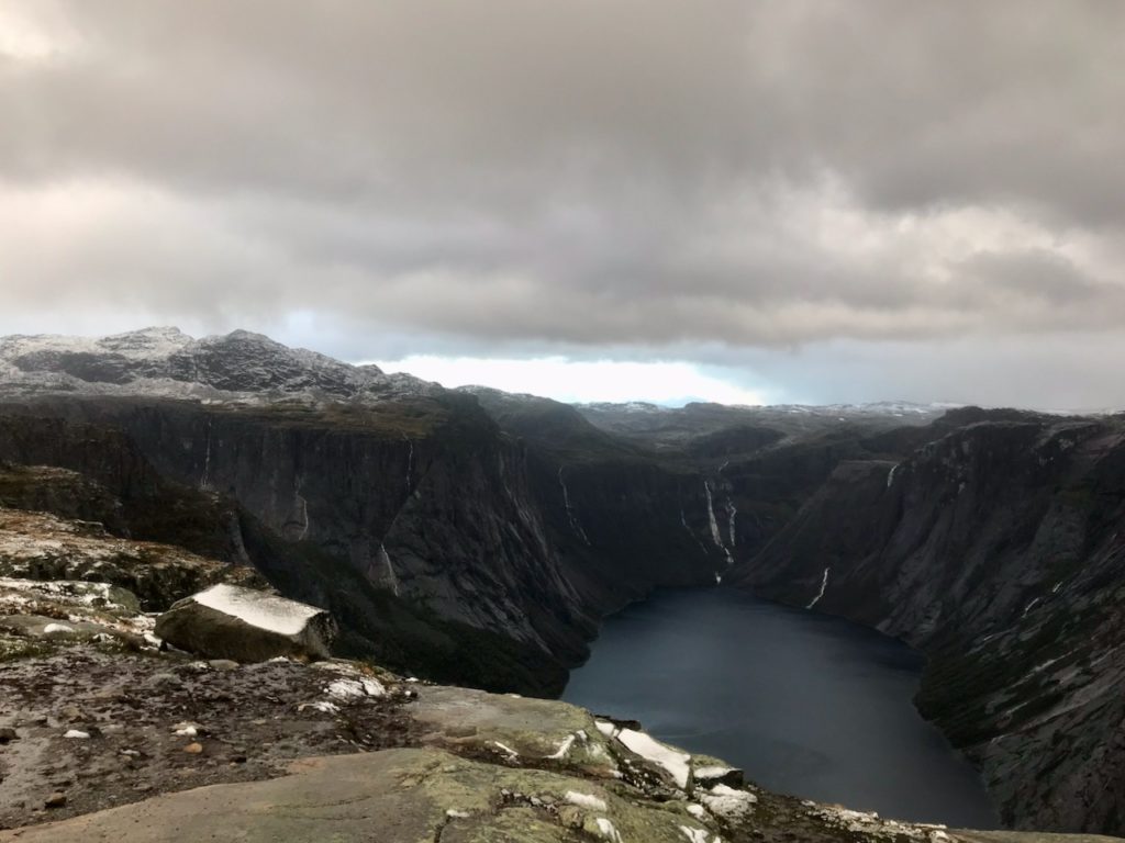
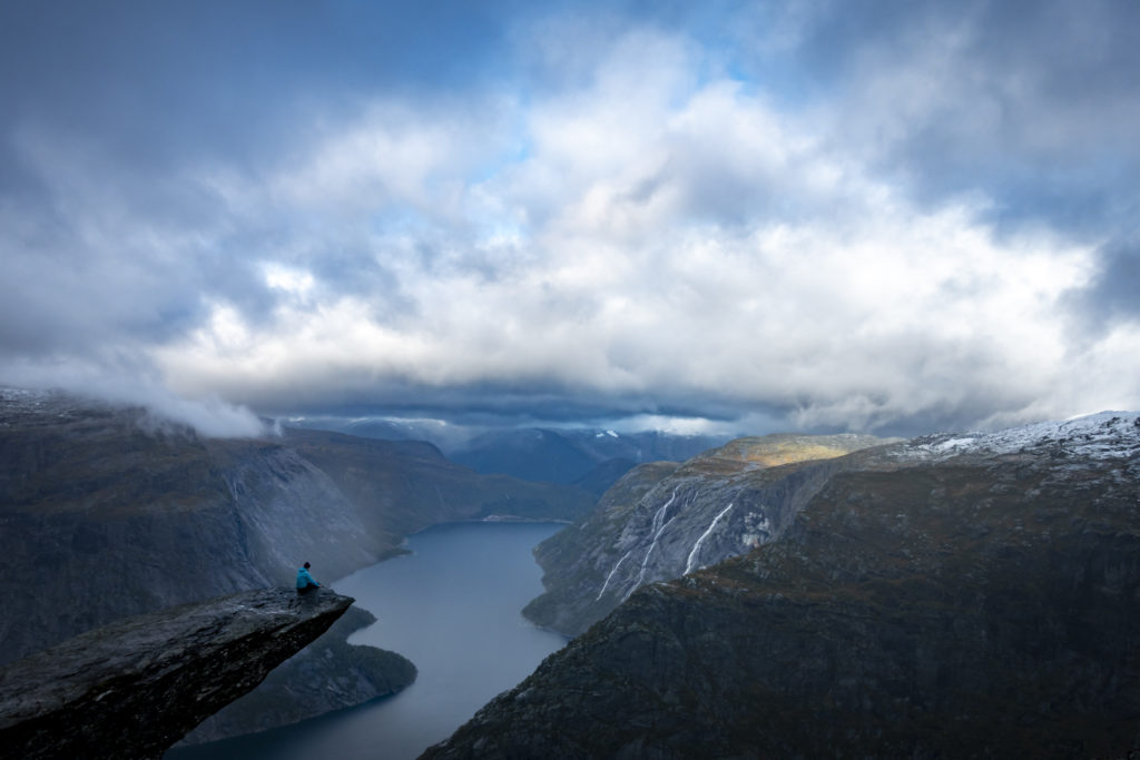
The “Troll Tongue” is a small rock plateau 700 m above the lake Ringedalsvatnet.
The hike starts at parking lot 1 in Tyssedal, parking lot 2 in Skjeggedal or parking lot 3 at Mågelitopp. A bus from Odda goes to the parking lots 1 and 2.
From Skjeggedal (parking lot 2) the hike is 28 km (round trip) with 800 meters of elevation gain. From Mågelitopp (parking lot 3) it is 20 km and 320 meters of elevation gain.
Between parking lot 2 and parking lot 3 the trail leads along an asphalt serpentine road. It is 4 km and 400 meters of elevation gain. In my opinion, there is no longer the possibility to walk the route through the forest.
Camping is forbidden on the first 3 km after parking lot 3. Before the Trolltunga it was stony and wet, so I had difficulties to find a suitable place. On my next visit I would look for a campsite behind the Trolltunga and also visit a “small Preikestolen” 20 minutes behind the Trolltunga.
Trolltunga
From Lysebotn I take the ferry to Stavanger the next morning and continue by bus to Odda. At first I don’t get any joyful news at the tourist information in Odda. Due to the weather forecast with rain, snow and strong gusts of wind they advise against a hike to the Trolltunga in the next days. Nevertheless, my stubbornness and doggedness let me get on the bus at 16:30 to the starting point of the hike. Since I want to camp up in the mountains and the sun doesn’t set until 7pm, I’m well on time. The bus goes to the parking lot in Skjeggedal. 4 km further and 400 altitude meters higher there is another parking lot, to which you either pay to drive your own car or walk at least 1 hour uphill on the asphalt road. When I am just about to march off, a car arrives that wants to drive exactly this route to the upper parking lot. I hold out my thumb and the men agree to take me in the car. Thus I cheat, but I am also spared a not so nice part of the hike and I can make it today even further than planned. Hallelujah! Once again more luck than brains.
After a few kilometers on the trail, it starts to snow. This hardly worries me at first, but when a white blanket covers the stones with the red trail markings, slight panic sets in. After briefly wandering around to find the next marked stone, the path quickly becomes a trail again and I can easily follow it. The plan is to pitch the tent by 8pm at the latest, regardless of how far I have come. But the closer I get to the Trolltunga now, the more I develop the ambition to reach it today. With increasing wind strength and dusk this will is opposed by reason and fear.
The struggle of ambition and reason leads to a scenario that could remind one of an evening at the club. Like a startled chicken, I run through the mud. Analogous to the lookout for men, I keep every possible camping spot in mind, but move on, hoping to find something even better. As the hour progresses and the storm sets in, I become more anxious. I run back, thinking I recognize one of the possible camping spots, but they seem to have disappeared. Back and forth, back and forth.
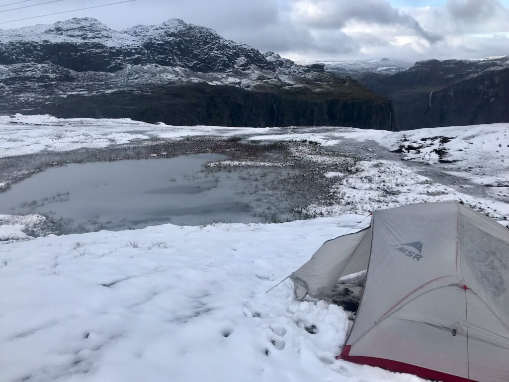
As I pass a sign indicating that Trolltunga is still 3 km away, the scene is interrupted by meeting a couple from England. They are also looking for a place to camp, but are coming towards me because they have not found anything further up. I want to try anyway and assure them that I also turn back if I do not find a place. Finally I place my tent next to a big stone on a sloping meadow above a small pond. As the storm seems to set in, the chicken runs no less rushing back and forth while setting up the tent and when it finally wants to retreat into the shelter…all of a sudden the cell phone is gone. Before the desired and urgently needed rest, the tension barometer rises again on a maximum level as I look outside in the wind and snow for my cell phone. Fortunately it fell only out of the hip belt when I loaded the backpack into the tent and lies in a hole beside the rock, where I discover it relatively fast. I recover with a small dinner in the tent and try to find sleep afterwards. But when my position suddenly seems more sloping than I thought, a thought doesn’t let me go. Is it possible to slide down into the pond together with the tent? Thoughts like this and the relief of the tent walls from the snow, keep me on my toes during the night. In retrospect, the snow has helped me during the night, because it has laid on the side vestibules and thus served as a windbreak.
At 7 o’clock the first hiking groups pass me and I am happy to see daylight and people again. I join them for the last part of the hike and discover that I have spent the night only about a kilometer from Trolltunga. Once there, we take photos and get to enjoy a small rainbow over Ringedalsvatnet. Since I am still restless from last night, I quickly set off again and walk about 3.5 hours back to the parking lot. With two Argentinians I hitchhike back to Odda. While I prepare a long-awaited meal with my camping stove at the bus stop, I meet two siblings from Berlin. They have spent the previous night in a shelter up in the mountains near the Trolltunga. There they were joined later in the evening by a couple from England. They reported about a girl who was still looking for a place to camp outside in the stormy dusk, but would surely come to the hut soon. As we know, she did not come…
The siblings Laura and Camilo also want to go to Bergen, so we set off together by bus and train. In Bergen I can spend the night in Laura’s Erasmus-WG and the next day I do a green kayak tour with Camilo. Because of rough sea, we don’t get out on the open water, but around the dock at the Fisheries Museum it is all the cleaner for it. Over coffee I tell him about the idea of writing a travel blog, but that this idea seems too far-fetched to me. With a completely checked off Norwegian Bucket List I fly in the evening from Bergen back to Berlin. And if she has not slipped into the pond, then she still hikes today. 😉
Peace out, drop the mic.
Greetings
ich