The Swedish Höga Kusten - Heading north on the High Coast Trail

The Höga Kusten-leden is 128.6 km long. 

The trail is divided into 13 stages, which are between 5 and 14 km long. 

You can do the trail in 5 to 7 days. Or in 9 days, like me. As we know, more is better 😉

The highest point of the trail is with 286 m the Skuleberget.

Arrival

I am sitting in the bus from Stockholm to Hornöberget full of excitement for my first long distance hiking trail in Sweden, the Höga Kusten-leden.On my journey north, it’s practically on the way and the few field reports I can find on the internet sound inviting. It’s mid-August and I’ve been in Sweden since the beginning of the month. Now I’m looking forward to the 128 km along the Swedish Baltic coast between Hornöberget and Örnsköldsvik. The “High Coast” belongs to the UNESCO World Natural Heritage. Here once lay 3 km of thick ice and the following ground uplift of over 285 m has produced a varied archipelago landscape, which I was about to explore.

I was still on the bus and shortly after leaving Stockholm, I’m faced with a decision that feels life-changing. I’ve just prepared myself breakfast – pour muesli into the camping cup, pour oat milk over it and start spooning. But as soon as I take my first bite, I realize something is wrong. The milk has gone bad. Okay, too bad about the muesli, which I could also have eaten dry. Now I must dispose everything on the bus toilet. This thought, an announcement of the bus driver follows that the board toilet is out of service today. Oh oh… In addition, he announces joyfully that this express bus does not make another stop between Stockholm and Hornöberget. With the cup full of sour muesli in my hand, I consider my options. Hold the muesli in my hands during the 8 hour ride, thereby missing out on any entertainment or sleep. Or keep spooning… I contact friends to support me on this existential decision. I get the hint from Tini that the consequences of continuing spooning could be fatal in the absence of an on-board toilet. Unfortunately this is true, it has not even crossed my mind yet. The decision-making keeps me busy for a while… luckily. After 15 minutes the bus stops once again at the airport in Stockholm, I climb out of the bus and dispose the breakfast in the street gutter. Cool, now I can still enjoy the bus ride.

I took the Y-bus from Stockholm and was in Hornöberget within 8 hours. Alternatively, you can take the bus to other places along the Höga Kusten-leden. In the Höga Kusten region itself, DinTur is the operating bus company. By train (SJ) it is possible to travel via Härnösand or Örnsköldsvik.

Day 1: Kilometers 1-10

After an 8 hour bus ride I stand with two other hikers, obviously also Germans, at the main road in Hornöberget. We walk up the driveway to the Höga Kusten Hotel and the tour information, where we can fill up our water supplies once again. It is 4 p.m. when I follow the first trail sign behind an information sign to Höga Kusten-leden. The first meters I am slightly uncertain due to lack of path and also because the other hikers from the bus have walked back down to the main road. Despite all doubts, I am quickly greeted by the 1st kilometer sign of Höga Kusten-leden. The following kilometers lead partly along the road, partly through forests. After 10 km I reach the small village Lövvik at 20 o’clock. After asking, I may pitch my tent behind a café.

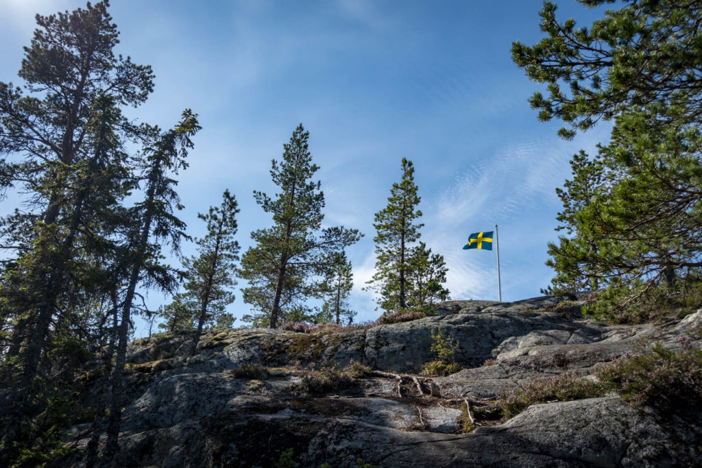
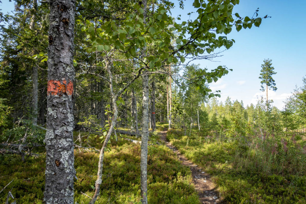
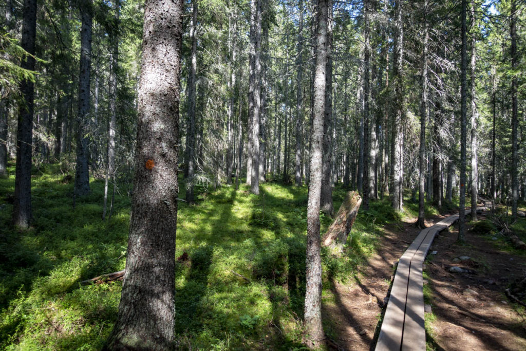
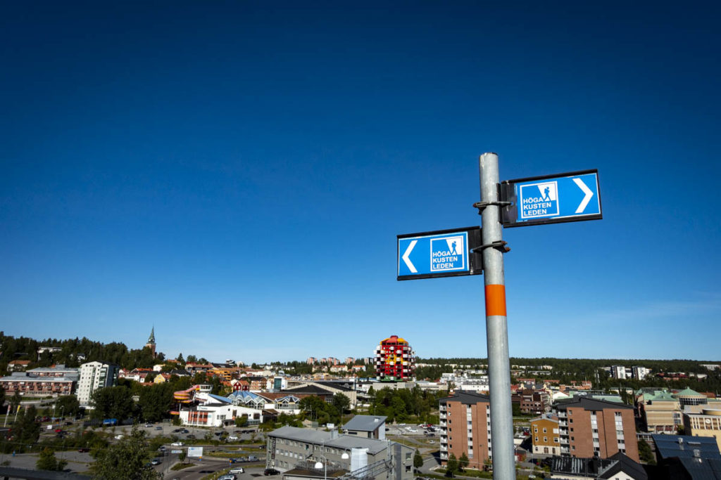
Always follow the nose…eh orange markings!

The route marking along the trail is excellent. There are blue signposts at branching points of the trail and in between orange stripes and dots. Only in Skuleskogen National Park I had problems to find the next trail signs.

There is a printed hiking guide for 10 €, in which the individual stages are marked with all possible overnight and supply points. You can buy the guide at the tourist information at Höga Kusten Hotel in Hornöberget. I myself did not have this guide, instead I downloaded the app “Höga Kusten”. The handling sometimes didn’t work so well, but I could always see where I was and also here the next accommodation and supply points were visible. Since the hiking guide in paper format provides a better overview of the individual stages and the app shows the current location via GPS, I would say that the combination of both guides provides the perfect basis for orientation.

Day 2: Kilometers 11-15

The next morning begins with a breakfast swim in the Baltic Sea. From a dock across the street, I hop into the water. The ground is unexpectedly muddy and I sink into the mud. For a moment, a flip-flop is lost and panic sets in. I manage to rescue it from the mud and push myself back onto the dock. Phew…we leave no man behind! 

It is already 11 o’clock when I move on to reach the coast after a few kilometers along the road. Here there is a lot of “Kusten”, little “Höga”, but in any case, walking along the stony coast accompanied by water and sun gives me a lot of pleasure. After 5 km I find a shelter right on the water. I find this spot so cozy that I would like to stay after my lunch. But that’s not possible, to call it a day after 5 km on the 2nd day at 15 o’clock, is it!?

Day 3: Kilometers 16-44

In my 1-room apartment with a view I wake up at 6 o’clock with sunshine in my face. It was great to sleep in the shelter and there were no visitors from animals either. Yesterday afternoon I used to set up my page on Instagram and publish the first pictures. So, the official start of Hike to work took place at a beautiful spot on the Swedish coast. The night before I also started my first own campfire, with success. It was a really nice place to stay.

Now it is time to move on. After a short sun salutation and a bath I go back on the trail. I get to know some other hikers. In the next few days we will always spend a few kilometers together and meet in the evening at the various places to stay, so that you even worry if someone does not show up. You could say I hiked the trail alone, but had good company with me.

Today’s kilometers are on forest and gravel roads in beautiful weather. After almost 30 km I’m exhausted and glad to arrive at the campsite, even if it costs 250 crowns. I use the opportunity to shower and wash clothes. Neither is yet really necessary, but one wants to get the most out of an investment. For drying I hang my panties and Co. on the local volleyball net. Unfortunately, it rains during the night, so the wet things accompany me for two more days, hanging from the backpack.

Day 4: Kilometers 45-64

Today, the orange dots and stripes lead us a lot along the road and through cleared forest. In Ullånger there is a shopping facility. Even though instant food has only been around for three days, I can’t wait for a chip bag (alright…and an ice cream). After the supermarket I walk another 5 km through the forest up a mountain. At the top there is a cabin camp at a lake, where I spend the next night in my tent. The other hikers also arrive one by one at the camp and we first chat about the highlight of the day – the achievements from the supermarket. As the sun sets behind the foggy lake, the day ends in a cosy atmosphere.

Day 5: Kilometers 65-76

After yoga on the dock and a swim in the lake, I start out on the trail. My first goal is the Fäberget for lunch break. The mountain is not directly on the way, but the day’s stage is not very long, so I gladly take the detour for the beautiful view. Afterwards I walk further to Skuleberget. There are many day tourists around this area and every second one is equipped with climbing gear. I do not remain unaffected by this. Right away I borrow the necessary climbing gear and before I realize it, I find myself hanging on the rope on the climbing route. 1.5 hours pass in which I climb to the summit. Within one day I have hiked up one mountain and climbed up another – am I actually a bit nuts? At the water near Skuleberget I find a camping site with an outhouse and running water for the night.

Eating raspberries and blueberries – all day long!

There are always blueberry and raspberry bushes along the route and the berries taste unbelievably good. Also elsewhere, the food supply works quite smoothly. In August 2020 there are supermarkets in the towns of Ullånger (km 59), Docksta (km 74) and Köpmanholmen (km 100). You can’t complain about the water supply either. Every day there is access to fresh water or at least a stream as a water source. I didn’t have a water filter with me, but it certainly can’t hurt either.

Day 6: Kilometers 77-85

Exhausted by the challenges of the previous day, I drag myself over the next kilometers in humid heat. The day’s finish is the Skuleskogen National Park, where besides the coast mountains rise out of a primeval forest-like vegetation. On the high plateau of Slåttdalsberget, I have the long-awaited lunch break at 3 p.m. The peaceful passing clouds and the no less peaceful deep blue sea covered with islands characterize the moment.

After that, it’s going down … both in terms of altitude and my strength. With the about 23 kg heavy backpack I have my little troubles on the steep descent from Slåttdalsberget. Somehow I make it to the imposing Slåttdalsskrevan, a crevasse with 40 m high walls. The trail does not get easier afterwards. Half climbing, sliding and scrambling, I doubt that I have found the official way down to the coast.

Excerpt from my vividly written travel journal: “The way there was pretty badass.”

Within an hour, most of the elevation meters are done, and the rest of the descent goes better. I pitch my tent at the water next to a fireplace and right away it’s obvious that no one is going to get me out of here anytime soon.

Day 7: Kilometers 85-85

This day I spend on the coast of the national park. The day looks quite typical: in the most beautiful sunshine on the Swedish Baltic coast I do yoga, go swimming, walk along the coast, try myself in chopping wood, take a nap, write travel diary as long as the battery of my laptop lasts, build a (short-lived) water filter from a tea bag and fail to start a campfire. What a great day to relax in flipflops and without a backpack on my back.

Sweden_High_Coast_Trail_Skoleskogen

In the hiking guides (paper format and app) many campsites and shelters are marked. At designated sites you usually have access to drinking water (in my experience true at: Lappuddens Friluftscenter (km 44), cabin camp at Lake Mäjasjön (km 64), camping site near Skulebergets Havscamping (km 76)). I can only recommend the shelters along the way. I spent the night in the “Stranded” at km 15. The often bizarrely designed shelters were built by architecture students as part of the ArkNat project. Looking back, I would have liked to be braver and sleep in such shelters more often, especially in the cool tree house “The Tree Cube” at km 45 (instead of the campsite “Lappuddens Friluftscenter”).

Day 8: Kilometers 86-108

Knowing that I don’t have to go back up the way I came the day before yesterday, I happily leave my nice spot by the water and continue walking along the coast through the forest. After the national park, the path continues on a gravel road. By now it is nothing new that the High Coast Trail leads along roads from time to time. I pass a supermarket in Köpmanholmen and meet Tari from the Netherlands. For the rest of the day we walk together and look for a camping spot at Lake Balestjärnen. When the tents are set up and the first hunger is satisfied, it is still quite early, so we go to a viewpoint on the coast. There we have a great view over the archipelago and the sun shines in our faces. Back in the forest we try to start a campfire in the evening. But also in this evening this does not want to work – with my first attempt I probably had only beginner’s luck.

Day 9: Kilometers 109-128

On the last morning on the High Coast Trail I need much longer than Tari, so we say goodbye and arrange to meet in town for the evening. I sleep in, take a bath in the lake and start the last day quite relaxed. One last time on this hike, I clean up my organized mess, take down the tent and stow everything in and around the backpack. Meanwhile, each sock has its fixed place in the backpack, so I’m quickly ready saddled and set off at 10:30. The route leads first further through the forest. At a lake I have for lunch again Swedish (= sweetened) bread with red pesto, sliced cheese and tomatoes. A combination I would otherwise never come up with, but on the mountain, or while hiking, everything tastes good. One hour later I already walk through Örnsköldsvik towards the finish. Again and again (twice) you hear encouraging: “Only a few more kilometers”, at least that’s how I understand it with my non-existent knowledge of Swedish. Enjoying the last kilometers, I get smoothly emotional. It is a nice feeling to have hiked the 128 km and I am proud of myself. At 16:30 I reach the last marker in the city center of Örnsköldsvik. From there I take the bus to a nearby campsite, where I move in for the next two nights. To finish off my High Coast Trail experience, I have a finisher pizza with Tari in town that evening.

I had a great time on the High Coast Trail. There was beautiful scenery to see, I was very lucky with the weather, and I met a lot of nice people. I can recommend the trail if you want to get to the Swedish coast, or if you are in the area anyway and you enjoy doing a long distance hike. However, the more beautiful sections of the trail can also be approached by car and can be explored in day trips. What you will miss are mainly the kilometers along roads or field paths and beautiful nights in nature. No matter how you approach your adventure “Swedish Höga Kusten”, memorable impressions are guaranteed.

Kind regards

me

Sweden_High_Coast_Trail_Oernskoeldsvik

Leave a Reply